home

[ Content | Sidebar ]

Borgo Medievale in Torino – I 🇮🇹

September 4th, 2016

International Volvo Photo Locations Part 220
Click for Volvo Photography Locations Overview

1977 - Volvo 264TE

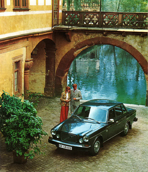
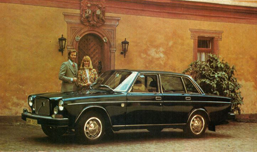
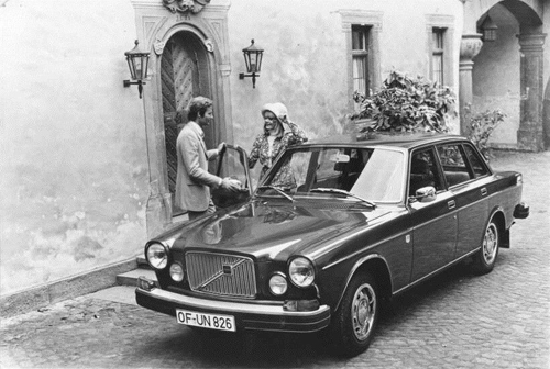
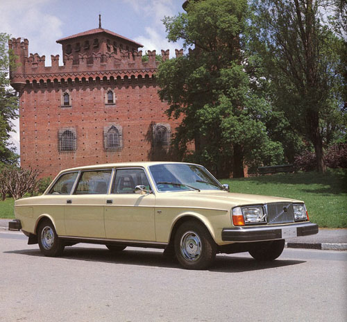
1977 – Volvo 264TE at Borgo Medievale in Parco del Valentino near Viale Virgilio in Torino, Italy 🇮🇹

1977 – Volvo 264TE at Borgo Medievale in Parco del Valentino near Viale Virgilio in Torino, Italy 🇮🇹

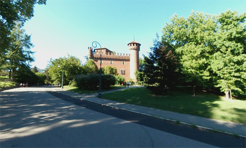
2016 - Borgo Medievale on Viale Stefano Turr in Torino, Italy (Google Streetview - Photo Sphere)

2016 – Borgo Medievale on Viale Stefano Turr in Torino, Italy (Google Streetview – Photo Sphere)

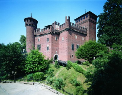
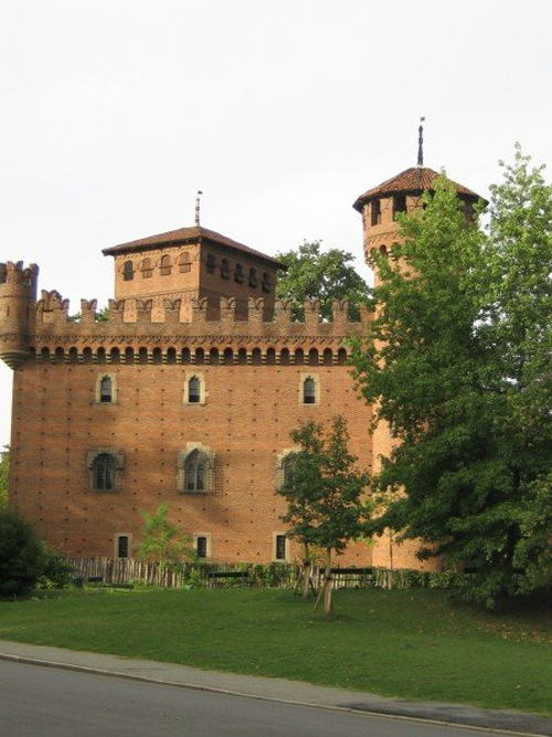
La Rocca or The Castle of Borgo Medievale is located on Viale Stefano Turr and is part of the Parco del Valentino, on Viale Virgilio in Torino, Italy.

The Medieval Castle at the Valentino was built to host the Ancient Art section of the 1884 Turin Expo: along the Po river and surrounded by walls, the richly furnished castle rises above a small cluster of houses
and workshops.

2016 - Borgo Medievale in Torino

The buildings and the decorations are faithful copies of 15th century castles as most indications for the furniture and the settings came from the Civic Museum of Ancient Art. Within this great exhibition, that was meant to promote the industrial, technological and business development of the city, the medieval castle was intended as an educational and promotional tool.

The idea of the organizing Committee was to offer an artistic and evocative example of the gothic style which characterized 15th century in Piedmont: a century of cultural and economic growth that blossomed under the duchy of Amedeo VIII, leaving many important monuments throughout the region that needed to be preserved and enhanced, as most of them were still unknown, even to scholars. Such models of taste and technique were presented as a precious lesson for the local industry and handicraft, to encourage the production of historically inspired works of high artistic level.

Many scholars, historians, technicians and artists of the time took part in the planning of the castle, under the supervision of architect Alfredo D’Andrade, together with artist and connoisseur Vittorio Avondo, already curator of the restoration of the Issogne castle in the Valley of Aosta, and Riccardo Brayda.

2016 - Borgo Medievale in Torino02

The Castle is the focal point of any tour inside the Borgo. The lord’s fortified living quarters are characterized by splendid rooms with gorgeous furniture, fabrics and furnishings, distinctive of the taste and customs of 15th century castle life. “The house needs to be vibrating and animated, everything must be placed as if we were to live it as it was” as the 1884 catalogue read. The armory shows armors and arms, flasks and hoods; in the dining hall the cupboards reveal embossed kitchenware and pottery while game hangs in the kitchen…

On the first floor, after the throne room with pictures of the valiant heroes and heroines inspired by the Chevalier Errant of Tommaso III of Saluzzo, we find the baron’s bedroom, where the great canopy bed stands out with
the coat of arms of Amedeo IX. The enchanting chapel is highlighted by frescoes by Giuseppe Rollini reproducing the works of Jaquerio di S. Antonio di Ranverso.

Turin or Torino is a city and an important business and cultural centre in northern Italy, capital of the Piedmont region. The city is located mainly on the western bank of the Po River, in front of Susa Valley and surrounded by the western Alpine arch and by the Superga Hill. The population of the city proper is 892,649 (August 2015) while the population of the urban area is estimated by Eurostat to be 1.7 million inhabitants. The Turin metropolitan area is estimated by the OECD to have a population of 2.2 million.

In 1997 a part of the historical center of Torino was inscribed in the World Heritage List under the name Residences of the Royal House of Savoy.

Turin is well known as the home of the Shroud of Turin, the football teams Juventus F.C. and Torino F.C., the headquarters of automobile manufacturers FIAT, Lancia and Alfa Romeo, and as host of the 2006 Winter Olympics.

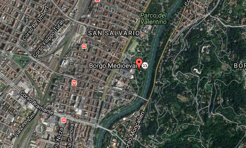
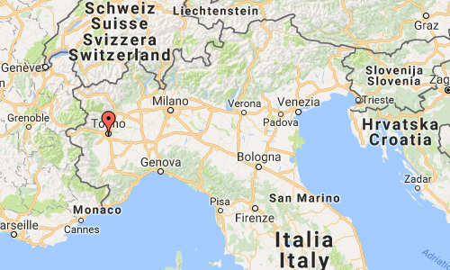
2016 - Borgo Medievale in Torino Maps02

2016 - Borgo Medievale in Torino Maps01

More information at it.wikipedia.org, www.borgomedioevaletorino.it and www.turismotorino.org.

Volvo Photography Locations

Apoteket Storken on Styrmansgatan in Stockholm 🇸🇪

September 3rd, 2016

Volvo Photo Locations Part 224
Historic Volvo Photography Locations Overview

2016 - Volvo V90 with Zlatan Ibrahimović on Styrmansgatan in Stockholm

2016 – Volvo V90 Inscription with Zlatan Ibrahimović @iamzlatanibrahimovic at Apoteket Storken on Styrmansgatan near Storgatan on Östermalm in Stockholm, Sweden 🇸🇪.

2016 – Volvo V90 Inscription with Zlatan Ibrahimović @iamzlatanibrahimovic at Apoteket Storken on Styrmansgatan near Storgatan on Östermalm in Stockholm, Sweden 🇸🇪.

2016 – Volvo V90 Inscription with Zlatan Ibrahimović @iamzlatanibrahimovic at Apoteket Storken on Styrmansgatan near Storgatan on Östermalm in Stockholm, Sweden 🇸🇪.

2016 – Volvo V90 Inscription with Zlatan Ibrahimović @iamzlatanibrahimovic at Apoteket Storken on Styrmansgatan near Storgatan on Östermalm in Stockholm, Sweden 🇸🇪.

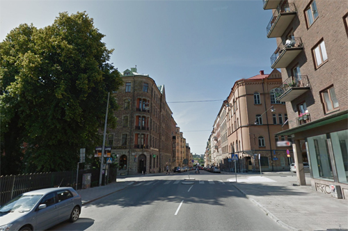
2016 - Styrmansgatan near Storgatan on Östermalm in Stockholm (Google Streetview)

2016 – Styrmansgatan near Storgatan on Östermalm in Stockholm (Google Streetview)

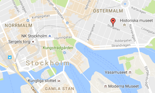
The location of this photo with Zlatan Ibrahimović is Styrmansgatan near Storgatan on Östermalm in Stockholm. Zlatan owns a house at the other corner of Styrmansgatan and Storgatan. In the background the known pharmacy ‘Apotek Storken’ is shown.

Styrmansgatan Östermalm, Stockholm, runs between Strandvägen and Karlaplan. It received its name in early 1640 due to the relation with shipping and sea people. The name relates to the role of navigation officer on a ship.

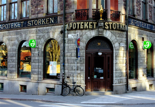
2016 - Apotek Storken

Apotek Storken is a pharmacy at the corner Storgatan and Styrmansgatan on Östermalm, Stockholm. The house was built between the years 1897-1899 by the architect and builder Hans Jacob Hallström (1840-1901) after his own drawings. The house has a well-preserved electric lift, which was among one of the first in Sweden.

Stockholms stadsmuseum has classified the building as a historical and inalienable and according to the National Heritage Board’s assessment is that the pharmacy historically most valuable in Sweden.

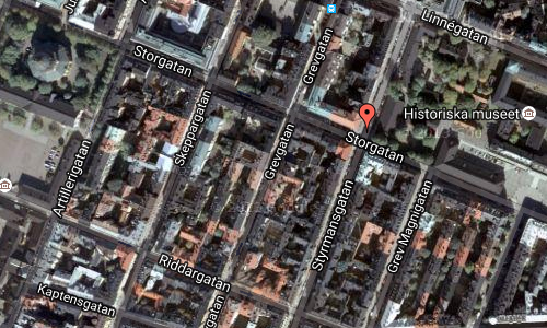
2016 - Styrmansgatan in Stockholm Maps02

2016 - Styrmansgatan in Stockholm Maps01

More information at sv.wikipedia.org/wiki/Apoteket_Storken, sv.wikipedia.org/wiki/Styrmansgatan, www.apoteket.se

Volvo Photo Locations

Schloss Mespelbrunn in Mespelbrunn – D 🇩🇪

September 3rd, 2016

International Volvo Photo Locations Part 218
Click for Volvo Photography Locations Overview

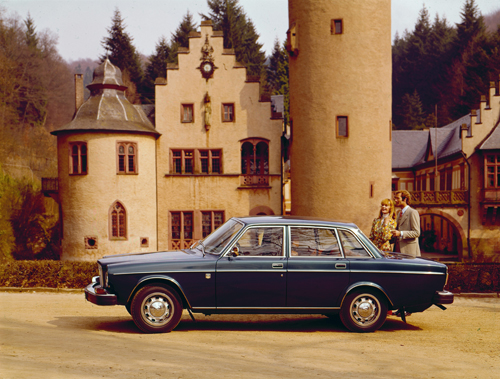
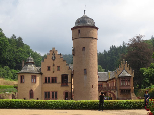
1974 – Volvo 164E at Schloss Mespelbrunn in Mespelbrunn, Germany 🇩🇪.

1974 – Volvo 164E at Schloss Mespelbrunn in Mespelbrunn, Germany 🇩🇪.

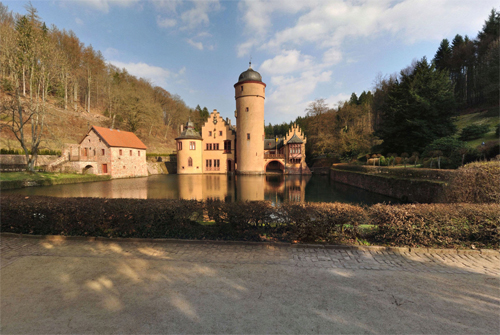
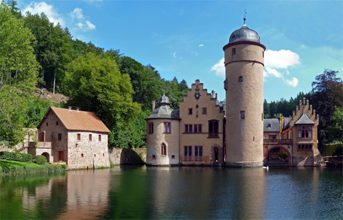
2016 - Schloss Mespelbrunn in Mespelbrunn, Germany

2016 – Schloss Mespelbrunn in Mespelbrunn, Germany (Google Streetview)

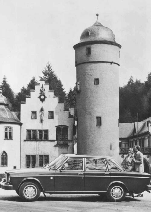
1974 – Volvo 164E at Schloss Mespelbrunn in Mespelbrunn, Germany 🇩🇪.

1974 – Volvo 164E at Schloss Mespelbrunn in Mespelbrunn, Germany 🇩🇪.

1974 – Volvo 164E at Schloss Mespelbrunn in Mespelbrunn, Germany 🇩🇪.

1974 – Volvo 142 de Luxe at Schloss Mespelbrunn in Mespelbrunn, Germany 🇩🇪.

2021 – Schloss Mespelbrunn in Mespelbrunn

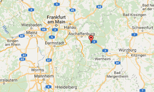
Schloss Mespelbrunn or Mespelbrunn Castle is a late-medieval/early-Renaissance moated castle on the territory of the town of Mespelbrunn, between Frankfurt and Würzburg, built in a tributary valley of the Elsava valley, within the Spessart forest. It is a popular tourist attraction and has become a famous Spessart landmark. Mespelbrunn is a community in the Aschaffenburg district in the Regierungsbezirk of Lower Franconia (Unterfranken) in Bavaria, Germany and a member of the Verwaltungsgemeinschaft (municipal association) of Mespelbrunn, whose seat is in Heimbuchenthal.

It is the site of Mespelbrunn Castle, one of the most famous landmarks of the Spessart region, and of the Wallfahrtskirche Hessenthal, for more than 700 years the destination of a Christian pilgrimage.

2016 - Schloss Mespelbrunn 03

The first precursor of Mespelbrunn Castle was a simple house. The owner was Hamann Echter, vizedom of Aschaffenburg, a title which means that he was the representative of the ruling prince, the Archbishop of Mainz Johann von Nassau-Wiesbaden-Idstein (de) at the castle and town of Aschaffenburg. On 1 May 1412, Johann gave the site, a forest clearing next to a pond, to Echter, a knight, who constructed a house without fortifications. It was a reward for Echter’s services against the Czechs. The Echter family (de) originates from the Odenwald region. Their name presumably means “der die Acht vollstreckt”, the executor of the ostracism. In the 15th century the Spessart was a wild and unexploited virgin forest, used as a hideout by bandits and Hussites, who despoiled the regions nearby. Therefore in 1427 Hamann Echter, the son of the first owner, began to rebuild his father’s house to a fortified castle with walls, towers, and a moat using the nearby lake.

2016 - Schloss Mespelbrunn 02

The main building of Mespelbrunn Castle is built on an almost square base on the eastern side of a lake. On the whole northern, western and southern side, the court is surrounded by two storied houses. On the northeastern and southwestern corner, towers of similar height are added to the houses. These are decorated with stepped gables on the western side. The main entrance is on the left side of the southern building. On the western side, the court is limited by two framed transits to the water and the main tower in center, which surmounts the castle.

In the 1930s, economic pressures forced the Ingelheim family (de) to open the site to the public. Today, Mespelbrunn Castle is still owned by the family of the Counts of Ingelheim, who live in the southern wing of the castle, having moved out of the main rooms.

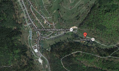
2016 - Schloss Mespelbrunn Maps02

2016 - Schloss Mespelbrunn Maps01

More information at www.schloss-mespelbrunn.de, en.wikipedia.org and www.spessart-erleben.de.

Volvo Photography Locations

Skywave House on Indiana Ave in Venice – USA 🇺🇸

September 3rd, 2016

International Volvo Photo Locations Part 219
Click for Volvo Photography Locations Overview

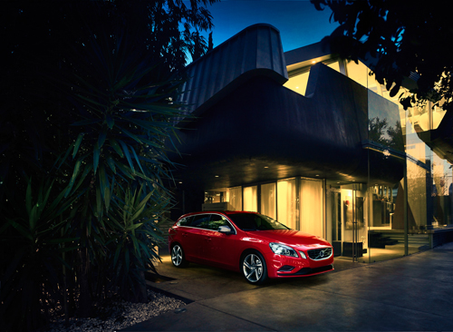
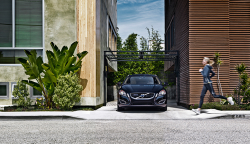
2013 - Volvo V60 R-Design, somehwere in the LA or SF area?

2013 – Volvo V60 R-Design at Skywave House on Indiana Ave, Venice, CA, USA 🇺🇸

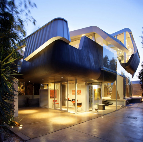
2016 - Skywave house on Indiana Ave in Venice Los Angeles USA (homedsgn)

2016 – Skywave house on Indiana Ave in Venice Los Angeles USA (homedsgn)

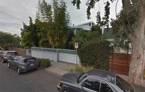
2016 - Skywave house on Indiana Ave in Venice Los Angeles USA (Google Streetview)

2016 – Skywave house on Indiana Ave in Venice Los Angeles USA (Google Streetview)

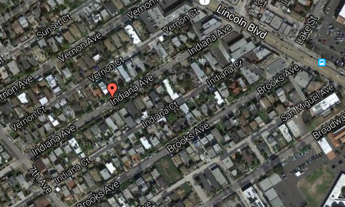
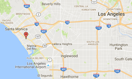
The Skywave house is located on Indiana Ave, between 7th street and Lincoln Avenue, in Venice, Los Angeles, USA.

Anthony Coscia, principal in Coscia Day Architecture and Design, created for himself and his wife a 2,250 square foot home on a 40 ft wide suburban lot in the artistic neighbourhood of Venice, Los Angeles, in California.
The Skywave house is a hovering sculptural form emerging from a single articulated plane that contorts to produce unique interior spaces over a tall-glassed in first level.
A curved sheet of steel provides shade and protection, while the increased sense of space is accomplished with large glass walls, an enclosed outdoor living room and the multi level open plan.

The Skywave House is a highly crafted, sculptural object that is more than just a stand-alone monument. This is a livable work of architecture that draws sustenance from its milieu, while reshaping that milieu through the framing and sequencing of perception. It doesn’t just sit in space, it makes space.

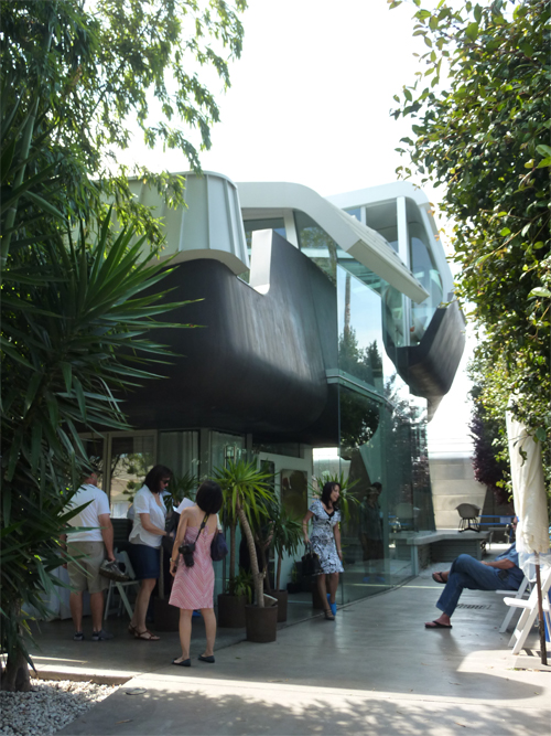
2016 - Skywave house

The most singular feature of the design is the continuous surface plane—a hovering, form-giving wrapper—that curls around and through it like a calligraphic brush stroke. This free skin loosely encloses the free-plan interior. No columns or walls encumber the views or the flow of living space, which unfolds upon three floating platforms connected by the full-height atrium. The stepping levels, or half-levels, provide a measure of privacy and spatial differentiation. The few partitions that do exist rise only to seven feet (2.13 m), then dissolve into glass panels that meet the continuous ceiling surface, which in turn blurs into the walls and floor. Detailed with minimalist precision, the frameless, transparent glazing draws the surrounding environment inside. The architect explains that the two-tone exterior cladding of black-toned stucco and white-painted sheet metal is inspired by the yin-yang—symbol of a balanced whole.

2016 - Skywave house Maps02

2016 - Skywave house Maps01

More information at skywavehouse.com, www.domusweb.it, www.homedsgn.com and cosciaday.com.

Volvo Photography Locations

Anna Queens Stræde in Helsingør – DK 🇩🇰

August 31st, 2016

International Volvo Photo Locations Part 217
Click for Volvo Photography Locations Overview

1970 – Volvo Amazon in Anna Queens Stræde 2 in Helsingør, Denmark

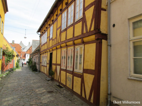
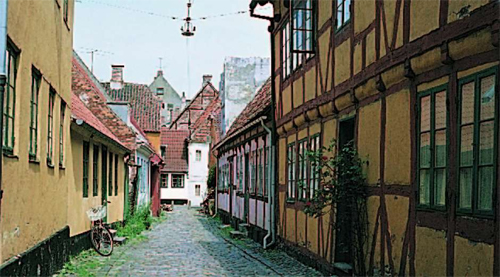
2016 - Norske Løve on Anna Queens Stræde in Helsingør, Denmark.

2016 – Norske Løve on Anna Queens Stræde in Helsingør, Denmark.

Anna Queens Stræde in Helsingør is one of the oldest streets in Helsingör, Denmark. Above the door of the house a texts is shown: Norske Løve.

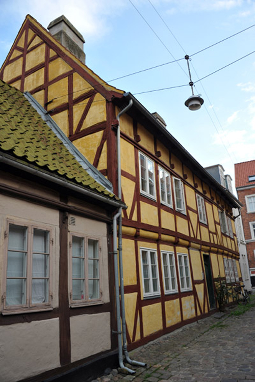
This fine little cobbled street is one of the oldest and has been here since the 1600s. At that time was called “Moellestraede by Svingelen” and the “small Moellestraede”. The street’s current name has nothing with the royal to do. But is because the merchant family Quie, who in the 1700s owned several properties on the street.

The name Anna Queen was in fact Quie surname and was the widow of grocery Hans Quie.

2016 - Norske Løve on Anna Queens Stræde in Helsingør, Denmark.

2016 – Norske Løve on Anna Queens Stræde in Helsingør, Denmark.

Once housed the inn and tavern “Norske Lion.” The house was built in 1770 by a ferryman and over the 1800 and 1900 been rebuilt several times.

2016 - Norske Løve on Anna Queens Stræde in Helsingør, Denmark.

2016 – Norske Løve on Anna Queens Stræde in Helsingør, Denmark.

Norske Løve was a ship with 36 cannons owned and operated by the Danish East India Company. The ship’s bell is dated to 1704, although a Norske Løve was recorded as running a cargo of slaves for the Danish East India Company in the Indian Ocean in 1682. Similarly, a Norske Løve is recorded calling at the Danish colony of Tranquebar in 1690 and 1706, although this may have been one of the numerous Dano-Norwegian Navy vessels of that name.

A poem (folk song) about the event is commonly used accompanied with the Faroese chain dance in the Faroe Islands, it is written in Danish. The title is Norske Løve. The Faroese author Jógvan Isaksen has written a crime fiction with the title Norska Løva, published in 2010.

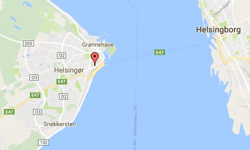
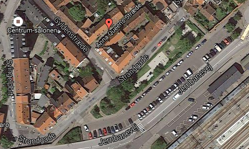
2016 - Norske Løve Maps02

2016 - Norske Løve Maps01

More information at www.danskefilm.dken.wikipedia.org and en.wikipedia.org/wiki/Helsing%C3%B8r.

Volvo Photography Locations

Mildred Ave in Los Angeles – USA 🇺🇸

August 31st, 2016

International Volvo Photo Locations Part 216
Click for Volvo Photography Locations Overview

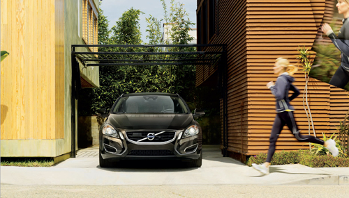
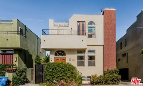
2013 – Volvo V60 at Mildred Ave 661-663 in Los Angeles USA

2013 – Volvo V60 at Mildred Ave 661-663 in Los Angeles, USA 🇺🇸 (Photography by Anton Watts)

2013 - Volvo V60 at Mildred Ave 661-663 in Los Angeles, USA

2013 – Volvo V60 at Mildred Ave 661-663 in Los Angeles, USA 🇺🇸 (Photography by Anton Watts)

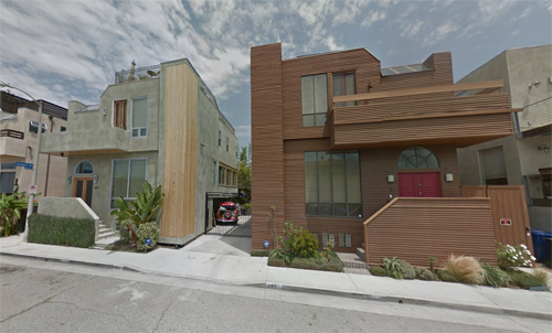
2011 - Mildred Ave in Los Angeles, California, USA (Google Streetview)

2011 – Mildred Ave in Los Angeles, California, USA (Google Streetview)

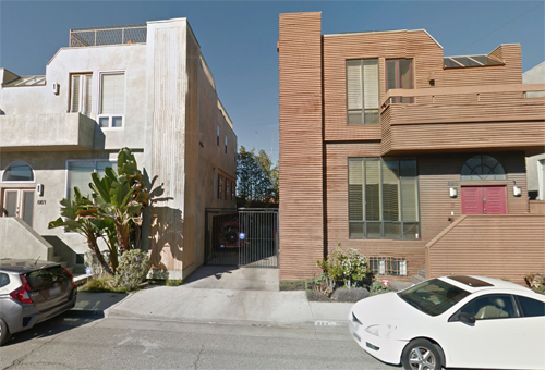
2016 - Mildred Ave in Los Angeles, California, USA (Google Streetview)

2016 – Mildred Ave in Los Angeles, California, USA (Google Streetview)

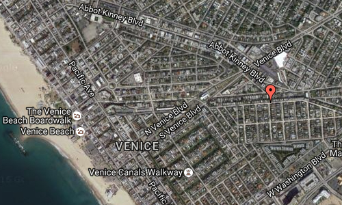
Mildred Ave is a street in the Venice area in Los Angeles, California, USA.

Venice is a residential, commercial and recreational beachfront neighborhood on the Westside of the city of Los Angeles.

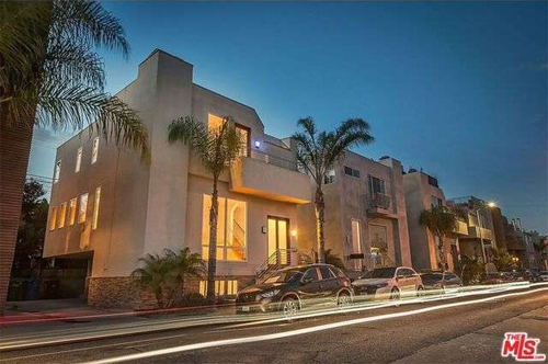
Shown houses a modern architectural homes located in the desirable Silver Triangle. Enter into a vast open living room with fireplace and floor-to-ceiling windows. Three bedrooms upstairs including an opulent master with a balcony and fireplace. Downstairs den could be ideal for a studio or office. The property features hardwood floors and high ceilings throughout, an abundance of natural light, a side yard for barbecuing, and direct access two car covered garage. Close to the beach, Venice Canals, and ample restaurants and shops on Abbot Kinney. Style is Single Family Detached and Year Built: 1981.

The neighborhood surrounding this modern-organic, three-story home at Mildred Avenue was originally named “Venice of America” by its founder, Abbot Kinney, for its Venetian-inspired canals. The beach side area later became the go-to locale for Southern California Beat Generation artists and poets and the birthplace of The Doors. To say that the Venice Beach community is an inspiring place to call home is somewhat of an understatement. It’s also why this newly remodeled condominium fits right in.

These three bedroom, three-and-a-half bath homes were a dream project for the design team of local-area talents.

2016 - Mildred Ave 02

With the eclectic collection of high-end boutiques, art galleries, restaurants and bars a short walk away at the popular Abbot Kinney, new homeowners can easily partake in the city’s long-established artistic, hip culture.

Located just north of Washington Boulevard and east of the Venice Canals is a quiet residential neighborhood referred to as the Silver Triangle.
The Silver Triangle is predominately owner-occupied single family homes. There is one 70-unit condominium project. Built in the early 80’s, del Rey Colony, a self-contained town home complex surrounding a man-made lake, offers a contemporary, secure life style.

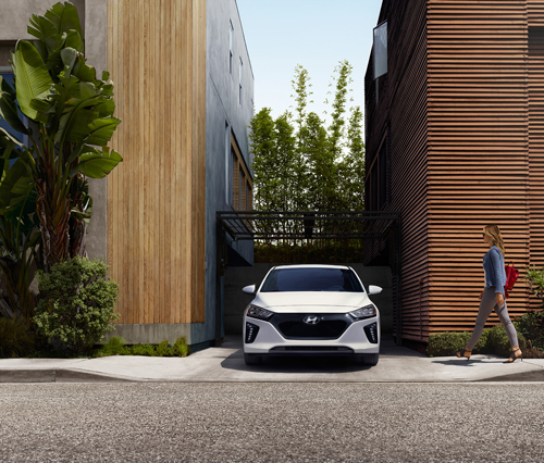
2017 – Hyundai at the same house in the same style…

Venice was founded in 1905 as a seaside resort town. It was an independent city until 1926, when it merged with Los Angeles. Today, Venice is known for its canals, beaches, and the circus-like Ocean Front Walk, a two-and-a-half-mile pedestrian-only promenade that features performers, mystics, artists and vendors.

2016 - Mildred Ave 01

Many of Venice’s houses have their principal entries from pedestrian-only streets and have house numbers on these footpaths. (Automobile access is by alleys in the rear.) The inland walk streets are made up primarily of around 620 single-family homes.[29] Like much of the rest of Los Angeles, however, Venice is known for traffic congestion. It lies 2 miles (3.2 km) away from the nearest freeway, and its unusually dense network of narrow streets was not planned for modern traffic. Mindful of the tourist nature of much of the district’s vehicle traffic, its residents have successfully fought numerous attempts to extend the Marina Freeway (SR 90) into southern Venice.

2016 - Mildred Ave LA Maps02

2016 - Mildred Ave LA Maps01

More information at en.wikipedia.orgdwellingz.com and www.venicebeachliving.com.

Volvo Photography Locations

Villa Ellesbo in Göteborg 🇸🇪

August 29th, 2016

Volvo Photo Locations Part 223
Historic Volvo Photography Locations Overview

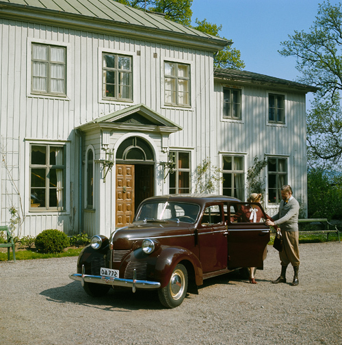
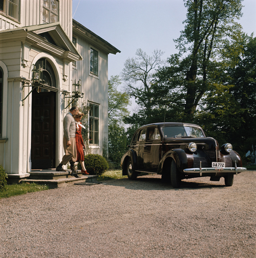
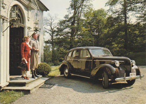
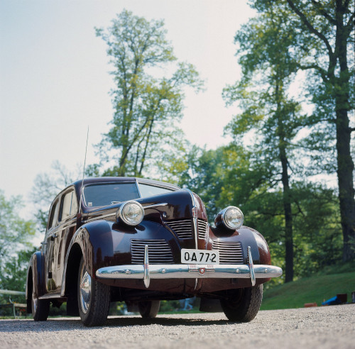
1973 - Volvo PV60 (1946)

1973 – Volvo PV60 (1947), north of Göteborg at Ellesbo Herrgård in Rödbo in Göteborgs kommun.

1947 - Volvo PV60 (photo from 1973)

1947 – Volvo PV60 (photo from 1973)

1947 - Volvo PV60 (photo from 1973)

1947 – Volvo PV60 (photo from 1973)

1947 – Volvo PV60 at Ellesbo Herrgård in Rödbo in Göteborg

1948 – Volvo PV60 at Ellesbo Herrgård on Ellesbobacken near Rödbo in Göteborgs kommun, Sweden 🇸🇪.
This photo was taken in 1973 by Volvo Cars for a book on the history of Volvo.

2022 – Ellesbo Herrgård
(source: www.facebook.com/nvcgbg)

2022 – Ellesbo Herrgård
(source: www.facebook.com/nvcgbg)

2016 - Villa Ellesbo on Ellesbobacken 4-6, Kungälv

2016 – Villa Ellesbo on Ellesbo backen(biketommy999)

2016 - Villa Ellesbo on Ellesbobacken 4-6, Kungälv

2016 – Villa Ellesbo on Ellesbo backen(biketommy999)

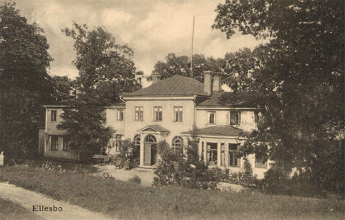
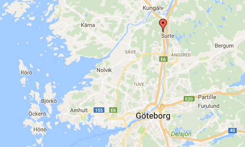
Villa Ellesbo or Ellesbo Herrgård is located at Ellesbovägen on Hisingen near Surte in Göteborg Kommun. The address is Ellesbo backen

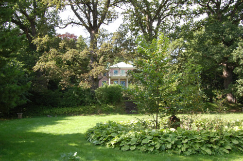
Ellesbo herrgård – view from the gardens
(Source: gotaalvdalen.se)

Ellesbo herrgård – view from the gardens
(Source: gotaalvdalen.se)

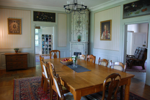
Ellesbo herrgård – interior room
(Source: gotaalvdalen.se)

Ellesbo herrgård – the iron gate near the road
(Source: gotaalvdalen.se)

Villa Ellesbo, is a mansion located in the district Rödbo in Göteborg. Carl Wilhelm Carlberg, city architect in Gothenburg designed in 1795 the Ellesbo mansion and the surrounding gardens for country accountant Fredrik Magnus Akerman. Villa Ellesbo was designed in an Italian inspired style with terraces from the villa down to the road and the Göta River.

1905 – Ellesbo gård with family posing in front of the house.

1912-1913 Ellesbo småskola

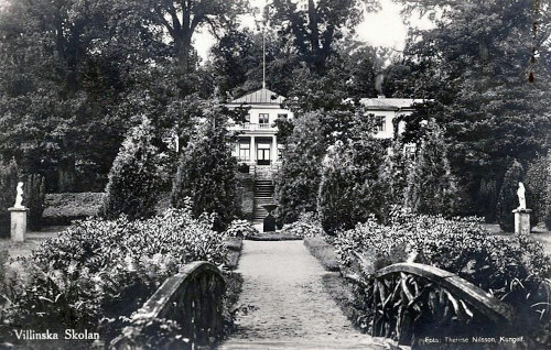
1925 – Villinska School

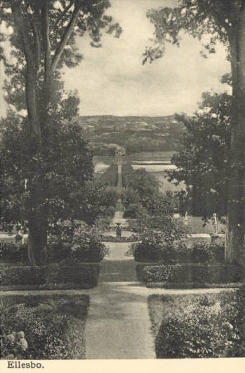
The garden has many rare trees and many of the impressive age, such as some ancient giant oaks. The exterior is rather repeatedly rebuilding and built. In the interior there are still some painted ceramic stove, which bears traces of the architect’s care in the interior of the villa. The garden decorated with marble sculptures, carp ponds and exotic plants.

2016 - Ellesbo vykort

Ellesbo Herrgården, the gardens with terrasses towards the Göta Älv river and Surte.

Carl Wilhelm Carlberg, who was born on 9 March 1746 at Örgryte and died on 8 April 1814 in Göteborg, was a Swedish architect, fortifications officer and Gothenburg’s first city architect. He is known for Gunnebo slott and Chalmerska huset.

2016 - Ellesbo Maps02

2016 - Ellesbo Maps01

More information at sv.wikipedia.org, www.goteborg.com, surteglasbruk.com, facebook.com/nvcgbg and natverkscentrum.se

Volvo Photo Locations

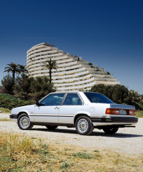
Marina Baie des Anges in Villeneuve-Loubet – F 🇫🇷

August 28th, 2016

International Volvo Photo Locations Part 215
Click for Volvo Photography Locations Overview

1985 - Volvo 780, somewhere on the Cote d'Azur near Nice?

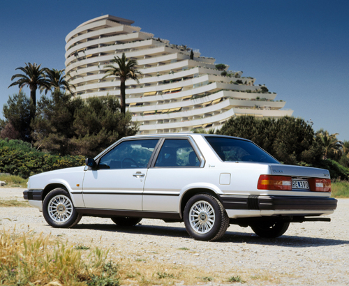
1987 – Volvo 780 at Marina Baie des Anges in Villeneuve-Loubet between Antibes and Cagnes sur Mer in the south of France 🇫🇷. Great photography for Volvo Cars by Thomas Dirk Heere !📸👍

1987 – Volvo 780 at Marina Baie des Anges in Villeneuve-Loubet between Antibes and Cagnes sur Mer in the south of France 🇫🇷. (AI Enhanced)

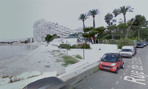
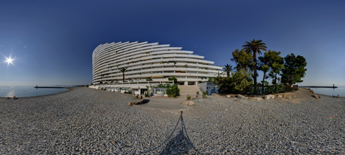
2016 - Marina Baie des Anges, seen from Rue de la Jetée in Villeneuve-Loubet France (Google Streetview)

2016 – Marina Baie des Anges, seen from Rue de la Jetée in Villeneuve-Loubet France (Google Streetview)

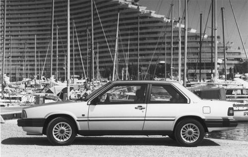
1985 - Volvo 780

1987 – Volvo 780 on Rue de la Jetée in Villeneuve-Loubet in France 🇫🇷. Great photography for Volvo Cars by Thomas Dirk Heere !📸👍

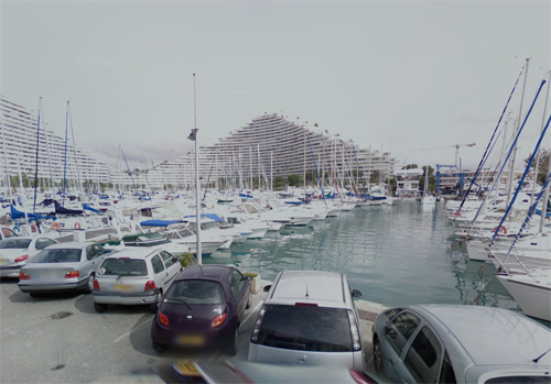
2016 - Marina Baie des Anges with Port Marina, seen from Rue de la Jetée in Villeneuve-Loubet (Google Streetview)

2016 – Marina Baie des Anges with Port Marina, seen from Rue de la Jetée in Villeneuve-Loubet (Google Streetview)

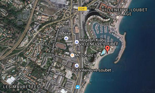
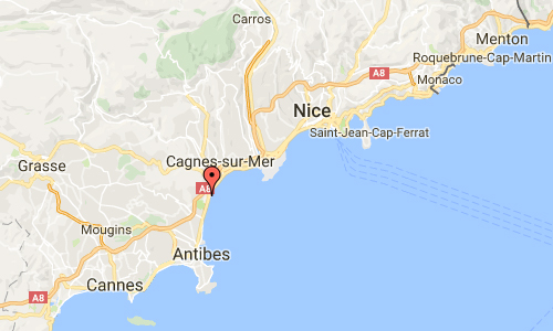
The Marina Baie des Anges in Villeneuve-Loubet is located between Antibes and Cagnes sur Mer in the south of France.

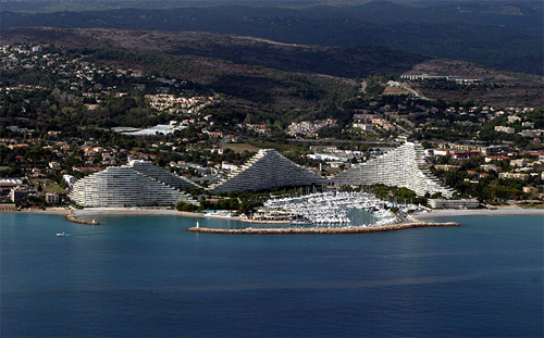
The Marina Baie des Anges is a set of four buildings that dot the Baie des Anges (Bay of Angels) and recall that the French Riviera is the queen recreational destination on the Mediterranean coast. It is also an original but sometimes challenged architectural work that earned him the label of Heritage XXth century.

Amiral Building, Marina Baie des Anges, Villeneuve Loubet

Transform a coastal wasteland, dedicated in part to campsites in postwar luxury residential complex, was the bet made in 1960 by Jean Marchand, the promoter who merged architect André Minangoy to define the project that received the approval of the top architecture and urban planning Council. The construction was launched in 1968, spanned nearly 25 years. Today 16 hectares are home to a marina with a capacity of 530 berths from 6 m to 35 m at the quay or pontoon, a shopping mall and four giant pyramids evoking huge white waves including nearly 1,500 housing .

2016 - Marina Baie des Anges in in Villeneuve-Loubet 2

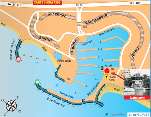
The four buildings forming the marina Baie des Anges respective names for the Admiral, Baronnet, Commodore and the Ducal.

2016 - Marina Baie des Anges in in Villeneuve-Loubet maps00

Minangoy André (1905 – 1985) was a French architect. He has worked in the Alpes-Maritimes, enjoying the glorious 30 that hit the French Riviera. The “Marina Baie des Anges’ in Villeneuve-Loubet is his most famous work.

2016 - Marina Baie des Anges in in Villeneuve-Loubet maps02

2016 - Marina Baie des Anges in in Villeneuve-Loubet maps01

More information at fr.wikipedia.orgwww.culturecommunication.gouv.fr and www.ina.fr.

Volvo Photography Locations

Det gule Hus on Kystvejen in Hanstholm – DK 🇩🇰

August 28th, 2016

International Volvo Photo Locations Part 214

Click for Volvo Photography Locations Overview

1975 - Volvo 244, somewhere on Gotland?

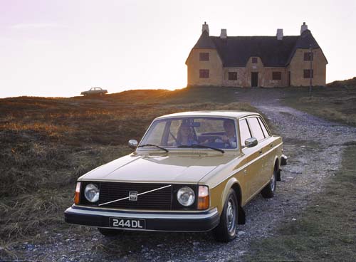
1975 – Volvo 244 at Det gule Hus, south west of Hanstholm in Denmark 🇩🇰.
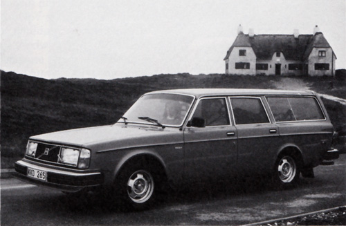
1980 – Volvo 245 GL at Det gule Hus, south west of Hanstholm in Denmark 🇩🇰.
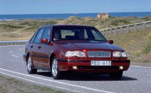
1995 - Volvo 440 at almost hte same location as above, near Det Gula Huset in Hanstholm Denmark.

1995 – Volvo 440 on Kystvej with Det Gula Huset in Hanstholm, Denmark 🇩🇰. Great photography for Volvo Cars by Thomas Dirk Heere !📸👍
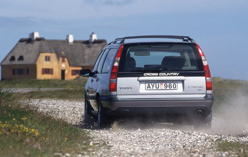
1998 – Volvo V70 XC AWD at Det gule Hus near Kystvejen in Hanstholm, Denmark 🇩🇰. Great photography for Volvo Cars by Thomas Dirk Heere!
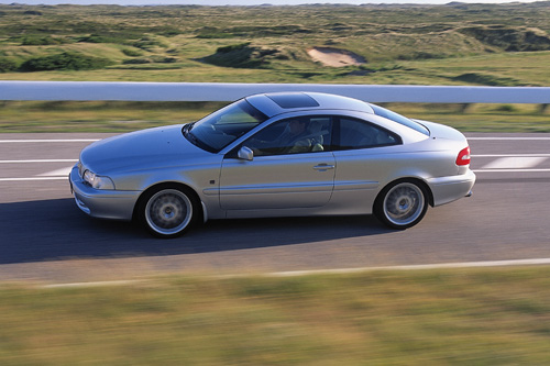
1998 – Volvo C70 Coupé on Kystvejen in Hanstholm, Denmark 🇩🇰.
Photography by Thomas Dirk Heere!
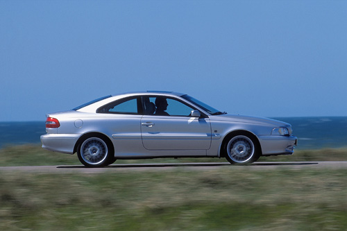
1998 – Volvo C70 Coupé on Kystvejen (alongside the coast south) in Hanstholm, Denmark 🇩🇰.
Photography by Thomas Dirk Heere.
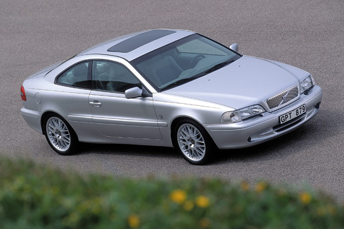
1998 – Volvo C70 Coupé on Kystvejen (near the harbor at the parking on # 1B) in Hanstholm, Denmark 🇩🇰.
Photography by Thomas Dirk Heere.
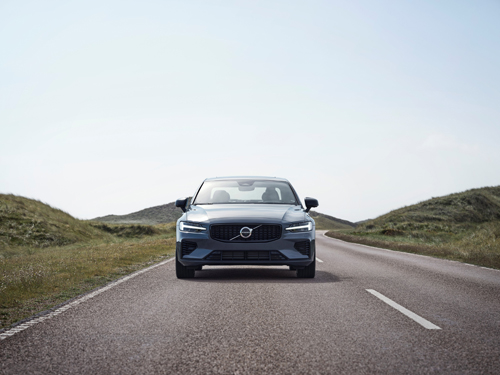
2022 – Volvo S60 Recharge T8 on Kystvejen in Hanstholm, Denmark 🇩🇰.
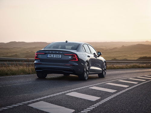
2022 – Volvo S60 Recharge T8 on Kystvejen in Hanstholm, Denmark 🇩🇰.
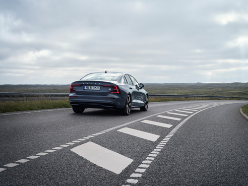
2022 – Volvo S60 Recharge T8 on Kystvejen in Hanstholm, Denmark 🇩🇰.
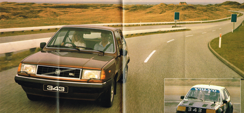
1982 – Volvo 343 GL (for UK market version) on Kystvejen in Hanstholm, Denmark 🇩🇰.
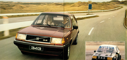
1982 – Volvo 343 GLS (for Dutch market version) on Kystvejen in Hanstholm, Denmark 🇩🇰.
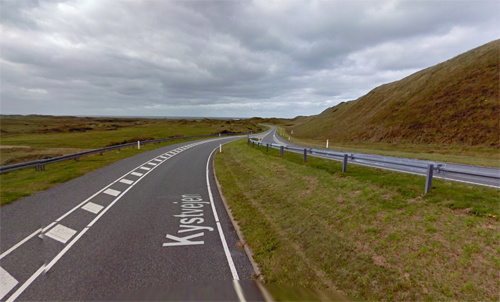
2009 - Kystvejen in Hanstholm Denmark (Google Streetview)

2009 – Kystvejen in Hanstholm, Denmark (Google Streetview)
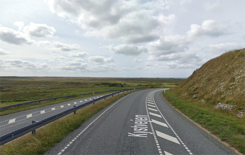
2022 – Kystvejen in Hanstholm (Google Streetview)
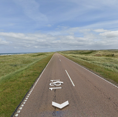
2024 – Kystvejen in Hanstholm Denmark (Google Streetview)
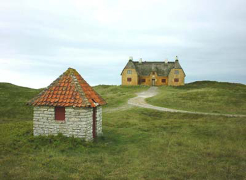
1999 - Det gula Hus at Hanstholm on Jylland in Denmark

1999 – Det gula Hus at Hanstholm on Jylland in Denmark

1967 - Det gula Hus with Kustvejen at Hanstholm, Denmark (source)

1967 – Det gula Hus with Kustvejen at Hanstholm, Denmark (source: mosejens.dk)

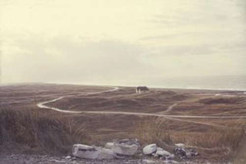
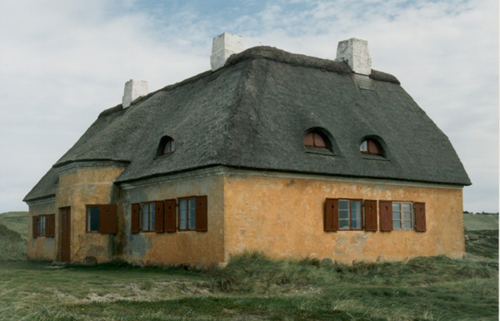
Det gule Hus (or the yellow house) was located between 1916 and 2000 south west of Hanstholm, on Jylland in Danmark. The house is also known as Strandgården or Nørtorp Strandgård (the official name).

Hanstholm is a small town and a former island, now elevated area in Thisted municipality of Region Nordjylland, located in the northern part of Denmark.

In the end of the 20th century, Denmark’s largest harbor was built in Hansted, and a 10-fold bigger harbor town was needed. A new town was planned, covering the places Hansted, Gårddal and Nørby, and the new town was officially named Hanstholm. This has led to quite some confusion, because the people from the towns Ræhr and Vigsø live on Hanstholm, the former island, they live in Hanstholm postal district, they live in Hanstholm municipality, but they don’t live in Hanstholm town.

However, since all the parts of this new harbor town belong to Hansted parish, and because Hansted has been the harbor town for so many centuries, many people refer to this town simply as Hansted instead of Hanstholm.

There are many reasons to visit Hanstholm, and many people do so:

  • Remains of the largest World War II fortress.
  • The largest industrial harbour in Denmark, with fish auctions at 6.30 in the morning etc.
  • West coast of Denmark. It’s rough, it’s windy.
  • Fishing. It is possible to fish in the ocean at the Yellow Reef, fish from the beaches or in put-and-take lakes.
  • Geology. The stone age coast line is visible, and it is even possible to find fossils at many places.
  • Nature. Hansted reservat and many places on Hanstholm have unique plants, animals and places that don’t survive in other places.
  • The lighthouse.
  • Small plane flying. There is a small airport nearby.
  • Excellent Windsurfing, surfing and kitesurfing scene, also known as “Cold Hawaii”

An article from the “Thisted Dagblad”, (March 29, 1975) about this yellow house wrote:

With faded and boarded oak doors the magic castle in the remote dunes located south of Hanstholm. When it was built in 1916, it was still the loneliest located castle of the country. No path led there and it was far away to the nearest habitation. Now cars drive on the new coastal highway passing, but few know that the castle close by the sea in his aloofness hides a piece of Danish history, and that princes and princesses had found here once a paradise in the white sunny dunes.

The yellow building with the black chimneys (later these were white) on the thatched roof, had another summer palace, namely “Klitgården” in Skagen as an example, as it was built in 1916 by the industrialist and shipowner Axel Olaf Andersen. On the oak post above the main entrance, a crossbar is connected to a Bark – the logo of the shipowner – carved Andersen wanted to “talk” with his ships passing by!
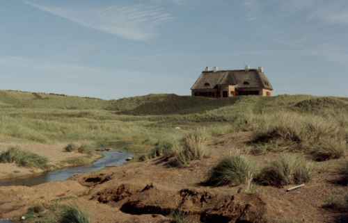
1999 - Det gula Hus at Hanstholm on Jylland in Denmark

1999 – Det gula Hus at Hanstholm on Jylland in Denmark, seen from the coast.

Why did this wealthy shipowner, whose name is inextricably linked build with lines such as “Valkyries”, “Viking”, “Gorm”, “Skold” and “Carl”, wanted a summer palace in this remote wasteland? Well, 1916 was still so far from the technological age, and in the Danish merchant fleet known to little of telegraphy and radio as a means of communication.
When the ships were many months on the seas moment during the First World War 1914-1918 go, the return was connected with great excitement. This led to build the shipowner in Hanstholm. If the vessels in the Skagerrak should enter bound for Copenhagen, Aalborg and Århus, Hanstholm was the first piece of Denmark, where they would show up and so Andersen would be first to know and could welcome his ships.

Close to his summer palace, AO Andersen built therefore a high signal mast, with which he communicated with the aid of signal flags in all sorts of patterns and colors with his ships, and could, if they were returning home passed the peak of Hanstholm or there dropped anchor. As the then Crown Prince Frederik was a friend of the shipowner and his son, a king room was set up in the yeloow house. Here even the stove had a royal crown as a hood!
Since both the Royals and the posh Copenhagen society visited the shipowner in his summer palace, which was christened “Strandgården” was decorated with many rooms and and a large fireplace room, where they could enjoy the twilight by the fire or the red sunset watching. “Strandgården” could provide as much comfort as a palace in the capital of Denmark, Copenhagen.
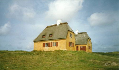
1998 - Det Gule Hus 03

Because of expropriation and land purchase in connection with the extension of the port at Hanstholm, “Strandgården” in 1921 the Danish state became owner of the building. It should be a house for the port project manager. But they had no real interest to live in a house that was so remotely located and had no road connection and had no neighbors!

A life artist and philosopher became then the lord of the manor for many years. For 322 crowns, the writer Bertel Budtz Müller (1890-1946) rented “Strandgården”. Actors, painters, sculptors and writers gathered around the cheerful and generous Budtz Müller, who always had herrings in a barrel, smoked lamb in the chimney, old cheese cellar and brandy in the cupboard!
During this time, the Summer Palace had a blue, a yellow and a red room. One of Budtz Müller evening amusements was to so set up his friends in front of the wall so that the candlelight cast a shadow of them on the wall and door. Bertel filled the shadows then with color and so received a portrait gallery of people who led the intellectual life in the twenties of the last century…

Was the vast Bertel Budtz Müller huge in seize with a deliberately walk, his successor at “Strandgården” was light footed as a deer: Ingeborg Brams!

The royal actress Ingeborg Brams (1921-1989) had to pay up to 1,000 crowns a year to rent “Strandgården” as a summer home. But as Bertel Budtz fit into the Adventure House, it was now a romantic frame around the new Ingeborg Brams, a slim woman from the national actor scene.
No one looked at her solitary wanderings in the 4000 hectare wildlife reserve, which was adjacent to “Strandgården”. Dunes, dune lakes, pine plantations and wide land were at its disposal. Here indeed no people lived there and no one went on a trip to these lengths.
The result once myths and rumors about the massive Bertil Budtz who could be dark and rumbling like the sea itself, when the problems were too much for him, the summer Ingeborg fit just perfectly into the panorama of the sun-bleached dunes and glittering dune lakes. She was a woman castle of the same aesthetic appeal as the evening mist that floated on warm summer evenings on the heath in enchanting dance of the hills.

In 1955 “Strandgården” was sealed and barricaded again. The last permanent tenant had departed forever…

In the later years “Strandgården” was the summer home of a doctors family from Copenhagen. Now they had to pay for a month as much as before in the whole year! In the evenings, the Hanstholm lighthouse set his bright rays over the sea. These also met “Strandgården” short bill and in this second castle was bathed in light.
In a few years “Strandgården” is no longer lonely. There will be a major expansion of Hanstholm harbor that will reach into the dunes and on this building. Then the house will be so close to the quay walls, that it will be a central location, sought after residential opportunity!

End of the article from 1975.

Unfortunately, the building has not survived time and was demolished in the autumn of 2000, after many protests of locals.
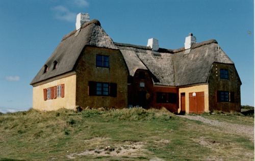
1999 - Det gula Hus at Hanstholm 04

1999 - Det gula Hus at Hanstholm 05

A yellow house. A small slot. An epoch.
By Flemming Skipper 

The yellow house in Hanstholm was demolished in late 2000 in connection with the expansion plans of the port. Before, there had long been a debate in the newspapers about the house with an interesting history – it was not worth preserving and could house does not have a role in modern Hanstholms history?

200 signatures were handed over to the Mayor Aase Jensen, but it was not enough to convince the governing authorities.

The argument for the demolition was that the house was in the way for the port’s future development, and if the house would be, it would be too expensive to restore.
October 30, 2000 was the demolition work started. Before that, the Museum of Thy and the North Hanherred photographed the yellow house, so that today it is possible to walk in the traces of the past. The house bar to the last imprint of the time it was built and decorated in. It had 700 people been able to ascertain, since a few years earlier – when the proceedings of the house’s future appeared – was an open house. The cars were parked close to the house and there was a throng of people in and out in five hours that were open.

The yellow house was built in 1916. It told a large stone that was walled in the front door. Nørtorp Strandgård – the official name of the yellow house – was built by shipping magnate Axel Olaf Andersen, called a tycoon whose ships sailed in the years around World War. He put a signal pole on the west side of the house. Using it, he could signal to his ships and get a first orientation on how the race had elapsed before the ships came to port. And that is the explanation for what caused a Copenhagen shipowner to build a summer residence at such a remote place as in the trackless terrain in Hanstholm Klithede.
The yellow house – the small castle – holiday resort of among other Crown Prince Frederik (Queen Margrethe’s father), who was a friend of Axel Olaf Andersen and his son. Crown Prince used extensively house during hunting. It was also the shipowner passion – beside the ships and asset management.
When there was a fine visit from the court and all his attentions were lit up in the fireplace hall, the castle many rooms were tastefully decorated. Cheerfulness, buttocks and fine hunting dinners with fine wines embossed The Yellow House in those years around the First World War.
In 1917 came the law on the port and thus began the state to expropriate an unbelievable Hanstholm. It was not until 1921 Nørtorp Strandgård changed hands. Since then belonged to the property state. The yellow house was to be used for rental. First of all, the port engineers – it had not much interest. There was not any real roads! But others saw the possibilities in the unique location in the middle of the dune landscape and so close to the sea.

All this is now history of lived life, one might imagine, when you look at the pictures that were taken just before decomposition machines took over to make room for modern times in Hanstholm.
1954 - Det Gula Huset on old map

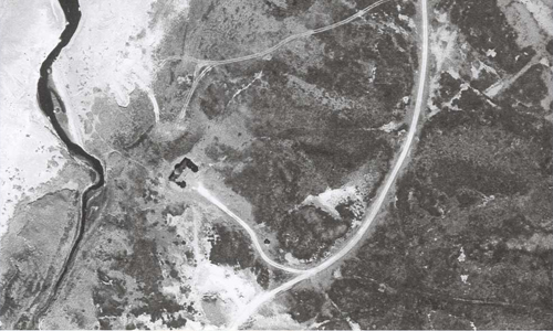
1954 – Det Gula Huset on old map

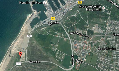
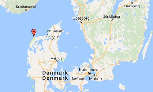
2016 - Det Gula Huset Maps02

2016 - Det Gula Huset Maps01

More information at www.arkivthy.dkwmosejens.dk, www.hanstholmregistreringen.dk and en.wikipedia.org.

Volvo Photography Locations

Östra Hamngatan in Göteborg 🇸🇪

August 28th, 2016

Volvo Photo Locations Part 222
Historic Volvo Photography Locations Overview

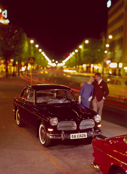
1961 – Volvo P120 Amazon on Östra Hamngatan in Göteborg

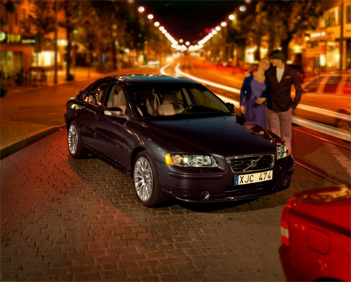
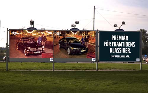
2007 - Volvo S60, 50 years later at the Kungsportsavenyen in Göteborg

2007 – Volvo S60, 50 years later, Östra Hamngatan near Kungsportplatsen in Göteborg (henrikhalvarsson.com)

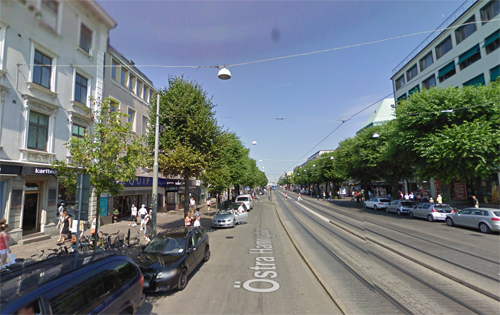
2009 - Östra Hamngatan in Göteborg (Google Streetview)

2009 – Östra Hamngatan in Göteborg (Google Streetview)

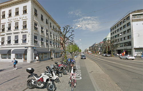
2016 - Östra Hamngatan in Göteborg (Google Streetview)

2016 – Östra Hamngatan in Göteborg (Google Streetview)

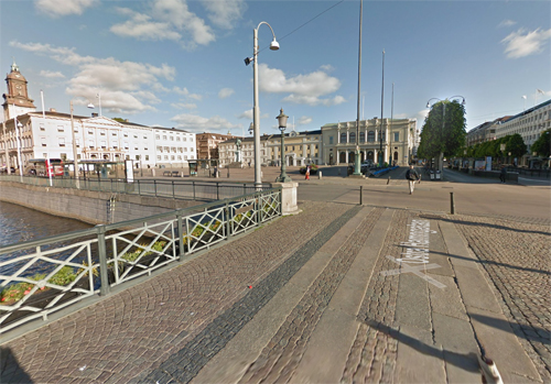
1970 – Volvo 144 Taxi on Fontänbron on Östra Hamngatan in Göteborg, Sweden 🇸🇪.

2022 – Fontänbron on Östra Hamngatan in Göteborg (Google Streetview)

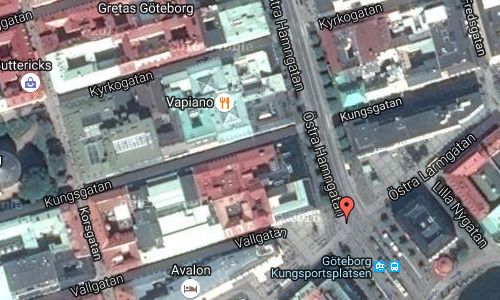
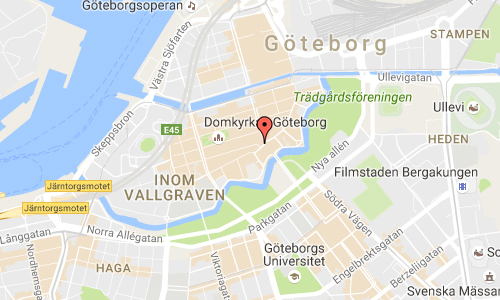
Östra Hamngatan is around 330 meters long street in Nordstaden and Inom Vallgraven i Göteborg. Stretching from Lilla Bommen at the Göta älv (Göta river) t0 Kungsportsplatsen, and is part of the great restaurants and shopping districts located in central Göteborg.
During the 1600s and 1700s was the area around the Östra Hamngatan towards Lilla Bommen many breweries. For example: Borgmanska bryggeriet; Stockmanska Bryggeriet; Thimska Bryggeriet; Williamsonska Bryggeriet and Åkerhögs Bryggeri.
On October 29, 1970, it was decided that the tram would continue over Östra Hamngatan, between Brunnsparken and Lilla Bommen and in July 1971 began trams on Line 5 to operate on the new double tracks.

Volvo Amazon vs. Volvo S60 as part of the Framtidens klassiker campaign in 2007

2016 - Södra Hamngatan Maps02

2016 - Södra Hamngatan Maps01

More information at sv.wikipedia.org, www.goteborg.com, Framtidens klassiker in 2007 and henrikhalvarsson.com.

Volvo Photo Locations